Sunday, 19 July 2009

OSGB GRID REF. NC747079. NR. ROGART

SARAH AND LOCHY AT HALKIRK
WOULD YOU EAT THESE BEANS?
TRIG POINT ON CNOC AN EIREANNAICH
TEA IN THE BOGS
Whilst clearing my gear from Mick's garden, Sarah, who works for him, prepared me coffee. She lives to the south of Halkirk and invited me to stop by her house on my way. I did, and was treated to another hot drink, a Penguin (the chocolate version) and a banana. She would be dog walking by Loch More later that day, a place I would be passing, so she offered to bring my rucksack along in her car later, enabling me to travel light for a while. With aching shoulders and feet, this was not an offer I was inclined to refuse.

We met again mid-afternoon, ten miles further on. After parting and with my rucksack restored to my shoulders, my pace slowed, and it was 8.00pm before I reached the sporting lodge at Glutt. It was raining heavily by now. I knocked on the Lodge door and Freddy Mackay, the Gamekeeper, offered me the use of the barn for the night. The temperature had dropped so I slept fully clothed, but enjoyed a comfortable night, to be woken by the continuing loud roar of heavy rain on the tin roof.

I took my time getting ready to move on, repairing a tear in my rucksack liner and attending to the well-being of my sore feet. Eventually I gave up witing for the rain to stop and started my way across the wetlands to Kildonan.

Initially I took a compass bearing south to the footbridge at Gobernuisgeach via Cnoc Loch Mhadadh. There is an old house by the bridge which is maintained by the estate as an emergency shelter and bothy for walkers. I stopped for a while, cooking and consuming the beans and sausages found in a rusty tin left by previous walker and enjoying tea made with Berriedale river water.

After making my entry in the bothy log-book, I continued across the bog towards Kildonan via the 517m Cnoc an Eireannaich. Crossing the bogland was not just wet, but totally exhausting. Huge concentration was required to avoid putting a foot wrong and ending up thigh-deep in gooey black peat. Also, circumnavigating the water pools that I couldn't jump doubled the 'as the crow flies' distance. If anyone wishes to look at the area south-west of Glutt using Google Map, it is every bit as bad on the ground as it appears from the satellite image.

My aching feet eventually brought me to the unmanned railway station at Kildonan at around 8.30pm. The flat grassy area behind the platform looked such a temping camping ground that I phoned Scot-Rail, who said 'fine'. What a nice company! However, I had forgotten about the dreaded Scottish midge which swarmed around and started to eat me the moment I stopped moving. The tent went up in record time and I bolted inside, quickly falling asleep to the rhythmic throbbing of my feet.

I awoke to a sunny Sunday 19, and cooked the dehydrated rice supper that I hadn't the energy to prepare the previous evening. More bogs to trot today, but the more clement weather made the experience less onerous. There were occasional dry bits of ground where I could sit down to rest unlike the previous day, and I found the time to appreciate the wonderful diversity of the bog-land plants.

The rain returned later in the day, but by then I had reached the road at Balnacoil along which I had a miserable trudge west until I'd had enough some 4 miles north of Rogart. In the rain, I erected the tent at the edge of the tarmac drive to 'Banscol Dog Kennels' and was howled to sleep.

Thursday, 16 July 2009

OSGB GRID REF. ND130594. HALKIRK

I GO, BUT THE SANDALS STAY
DUNNET HEAD LIGHTHOUSE AND FOGHORN
HAROLD'S (WONKY) TOWER, THURSO
A burst water main meant that I was unable to shower on the morning of Wednesday 15. Fortunately, I'd taken one the previous evening and also left enough water in the kettle for a cup of coffee. The B&B's Full English was consumed with ample milk and orange juice before I hauled my heavily-laden rucksack down to John o'Groats harbour for the traditional photo-session in front of the milepost. The photographer was absent when I got there so a young lad named Angus took one of me in front of the alternative sign on the slipway wall. I also symbolically disposed of the tatty sandals that I worn on the journey up.

Heading west, the trek towards Dunnet Head involved lots of rather dull tarmac trudging, although a refreshment stop at 'The Tea Cozy' in Mey represented a pleasant interlude, with other cafe customers expressing interest in my trek having seen the banner on my rucksack (thanks for making that, Rosemary).

The weather was warm and there was no rain, but visibility was poor, so I didn't bother with the extra climb to the viewing point when reached Dunnet Head Lighthouse at the most northerly point of mainland Britain. Satisfied at reaching my main goal of the day, I retreated south cross-county over the 'Moss of Dunnet' to Dunnet village. A 12-year old Highland Park whisky served by the very amiable Gemma at the Northern Sands Hotel put me in the mood for sleep, so I headed for the beach to camp amongst the dunes where I drifted off to the sound of gently crashing waves.

Whilst packing my gear in the morning, a lady dog walker who had seen me on the road to Dunnet the previous day invited me to illicitly use the facilities of the nearby caravan site where she and her husband were staying. Bette and Derek made sure I had some tea and toast in me before I continued my waterside walk to Thurso. From there, it was south on the B874 to Halkirk, dodging the oncoming cars as I walked in the gutter.

I imbibed at Halkirk's 'Top Bar', after which Publican Mick kindly invited me to erect my tent in his garden.

Tomorrow I head towards Glutt Lodge and the remote and boggy Flow Country, where communications are likely to be difficult!

Tuesday, 14 July 2009

OSGB GRID REF. ND380727. HERE AT LAST!

WICK STATION. HEART OF A THROBBING NORTHERN SCOTTISH METROPOLIS
DUNCANSBY LIGHTHOUSE. A BEACON OF HOPE?
LIKE NOSFERATU'S TEETH; DUNCANSBY STACKS
How do I manage it? Monday 13 finally arrives but, even given 6 months to plan this venture, I still end up with a last minute panic. With just an hour to get to Southampton Parkway to catch the 19.22 train to Scotland, I haven't packed and my lift is suffering from mechanical troubles.

Fortunately, Cotswold's Ben 'the Boot' Jones came to the rescue with a working car, but I still boarded the train with my rucksack only half full and the rest of my kit thrown into 3 plastic bags.

I spent the first hour of the journey checking the kit against my list as I loaded it into the rucksack. Fortunately nothing of significance had been forgotten. 

The rail journey took nearly 20 hours and required changes at Stafford, Crewe and Inverness. The 'end of the line' was Wick, which I reached at 14.55 Tuesday. After a quick look around the town, I caught the bus to complete the final 17 mile stretch to John o'Groats. After an evening stroll to Duncansby Head and back, I settled into the hospitable embrace of the Caberfeidh B&B (now called the Seaview Hotel) to write this and to enjoy my last night between sheets for a while.

Sunday, 12 July 2009

……..AND READY TO GO???

JULIAN CLEGG’S TASTY PAD IN CENTRAL SOUTHAMPTON
ME (RIGHT) WITH SIMON, SARAH AND MO RAHMAN FROM THE WALTHAM TANDOORI
Since my last entry, there has been little time for outdoor training. Friends have suggested I should fatten up for the walk but, as the deadline to leave approaches, everything I eat seems to get converted into nervous energy. Starting the walk should provide me with an opportunity to relax. 

On 22 June I was interviewed by BBC Radio Solent’s Julian Clegg on his Breakfast Show. He has adopted me as one of his ‘Julian’s People’ and will follow my progress during the trek with further live interviews. These are scheduled for 6.45am on Fri 21 Aug, Tues 8 Sept and Fri 9 Oct.

Other news includes a visit to the School of Health Sciences at Southampton University (www.southampton.ac.uk/healthsciences) where Professor Maria Stokes and her team are comparing the state of my legs before and after the walk. Rain kept attendance down at the Swanmore Carnival and Fete on 11 July, but the ‘Steve’s Long Walk’ stall still collected £87. Winners of the ‘Guess the Weight of the Rucksack’ competition were Swanmore residents Karl Challender and Chris McCarthy, who each received a £50 Cotswold voucher.

With my departure now imminent (i.e. tomorrow), I’d like to emphasise the huge contributions that are being made by my loyal team of helpers: Webmaster Simon Maple, Publicist Kay Feltham-Jones and Treasurer Sarah Webber. At our final meeting on Thursday 9 July, we were all generously treated to a farewell supper by the owners of The Waltham Tandoori.

Sunday, 21 June 2009

KEEPING UP THE TRAINING!

FOG ROLLING OVER NANTLLE RIDGE
THEY LET ME ALONE AS I LOOKED A BIT GRIZZLY (OR DO I MEAN GRISTLY?)
SUMMIT OF ROWTOR - A PERFECT CAMP SITE WHEN IT’S DRY AND WINDLESS
ISAAC GEOFFREY - AT LAST, I’VE FOUND SOMEONE WHO LOOKS UP TO ME!
MEDIA GURU KAY & HUSBAND CHRIS ATTEND STAND AT BISHOP’S WALTHAM FETE
On Saturday 17 May I undertook a 13 mile walk from Gosport to Bursledon in aid of the Rainbow Centre www.rainbowcentre.org organised by the Rotary Club of Bishop’s Waltham (don’t tell Cancer Research UK and the BHF). I have also shared a few 16-mile walks along the South Downs and, as usual, participated in the annual 32 mile BHF ‘Round the Harbours’ cycle ride.

I spent from Friday 22 - Monday 25 May in Snowdonia with my Outcast friends (www.the-outcasts.hampshire.org.uk). A group of us traversed the length of the Nantlle Ridge on the Saturday, then on Sunday I walked alone for 9 hours, starting and finishing at our campsite near Waunfawr and navigating a loop which included Moel Tryfan, Mynydd Mawr, Rydd Ddu, Foel Goch, Foel Gron and Moel Eilio. The rest of the Club ventured off to scramble and climb near to the other, more well-known, ‘Tryfan and the Glyders’ (which, to me, sounds more like the name of a pop group than a group of mountains). This popular area was heaving with people due to the wonderfully sunny, clear and windless weather. In contrast, I doubt I saw more than a dozen walkers all day. My social skills returned on the Monday when I shared a climb of Moel Hebog, near Beddgelert, before driving home.

The weekend of 30-31 May saw me on Dartmoor. Leaving the car at Bellever Youth Hostel, near Postbridge, I bog-hopped and tor-hopped north towards Okehampton on the Saturday, finding a wonderful place to wild-camp atop Rowtor (tors are those strangely formed lumps of granite commonly found near the tops of Dartmoor hills). I awoke before 6am Sunday and opened the tent flap to be greeted by sun streaming inside. After enjoying a leisurely breakfast, I ambled back south by a different route, just breathing in the atmosphere and drinking in the wonderful views with my eyes. Over the two days I visited 28 tors and walked 35 miles, which wasn’t bad for an unhurried trek across such rugged terrain with a fully laden pack. This gives me confidence that managing this sort of mileage on the JOGLE is not going to be a problem.

Great news on Thursday 11 June – I’m a Grandpa! Eldest son Richard and Alison have together produced Isaac Geoffrey – an 8lb 6oz bruiser. Can’t wait until he learns to walk.

Finally, there was a ‘Steve’s Long Walk’ stall at the Bishop’s Waltham Carnival and Fete on 13 June, where we collected over £131 in donations to my charities. Winners of the ‘Guess the Weight of the Rucksack’ competition were Sally Sharp of Botley and Rob Webley of Itchen Stoke, who each received £50 worth of gift vouchers, courtesy of my main equipment sponsor Cotswold Outdoor (www.cotswoldoutdoor.com) in Hedge End.

Monday, 11 May 2009

THE LAKE DISTRICT

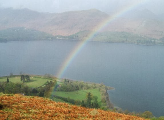
RAINBOW OVER DERWENTWATER
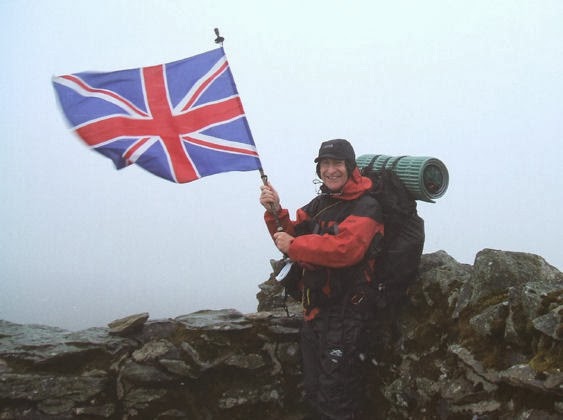
CLAIMING THE SHELTER ON A MISTY HELVELLYN SUMMIT
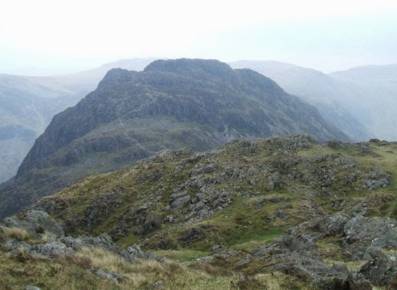
HAY STACKS FROM SEAT
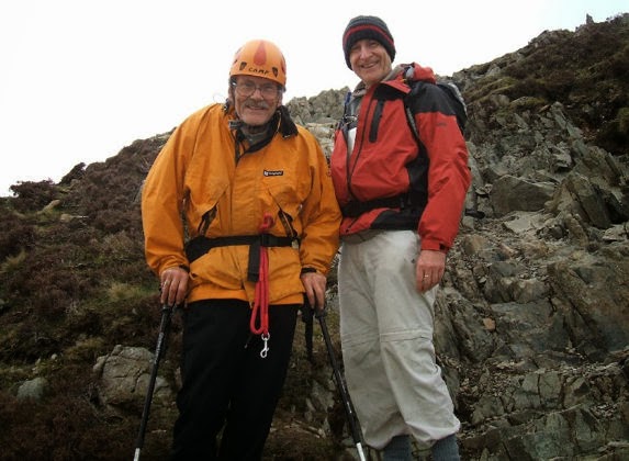
A VERY DETERMINED 75 YEAR OLD ON HAY STACKS
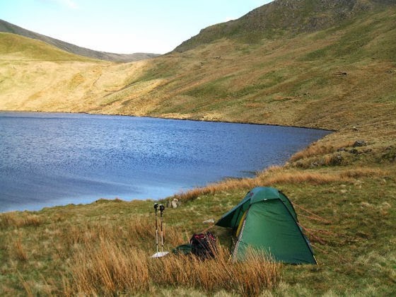
WILD-CAMPING BY GRISEDALE TARN
Those Lake District maps I purchased at the NEC Outdoor Show are now looking distinctly tatty following some heavy use. From 21-29 April I climbed 39 Lake District mountains over 2,000 feet (including Scafell Pike, Helvellyn, Skiddaw, Great Gable, Pillar and Blencathra) and 7 significant lesser fells (which included Catbells and Hay Stacks, the latter being the site of Wainwright’s final resting place).

I met a group of four friendly postmen at the fog-bound summit of Helvellyn. They handed me a Union Jack and proceed to photograph me as I victoriously claimed the storm shelter. Does this mean I can now live there? If so, were they there to deliver my very first letter? 

Most nights were spent sleeping in the back of the car, inconspicuously tucked away at the back of various car parks or down country lanes. Other nights were spent snuggled up in my nice new Mountain Hardware Lamina 20 sleeping bag and my even nicer new Hilleberg Unna tent next to Grisedale and Styhead tarns. Bliss. The Aarn Natural Balance bodypack that I acquired to carry all this stuff proved itself well up to the job, except that the slotted adjusters on the sternum straps had an irritating habit of partially unclipping themselves from the shoulder strap webbing from time-to-time. I will need to devise a fix for this. However, I came to the conclusion that if I can haul 18kg up the highest mountains in England then I should manage be carry this weight along my planned JOGLE route.

I was particularly impressed with a 75-year-old gentleman I met on the slopes of Hay Stacks. Although a bit wobbly, he was determined to climb this particular fell. He was wearing a helmet, and explained that this was necessary as he occasionally fell over and hit his head. No kidding. This chap has got to be given full marks for sheer dogged perseverance. 

Sadly my trip was curtailed two days early when news of my Dad’s death reached me. He had been ill for a while with bladder and prostate cancer, but the speed with which he deteriorated during my absence surprised me. At 81, he lived to be a good age, but the family will miss him, Mum more that anyone. It does add greater meaning to my trek, but I am sure that he will keep an eye on my well-being while I am walking.