Wednesday, 9 September 2009

OSGB GRID REF. SP11594. GREAT ALNE

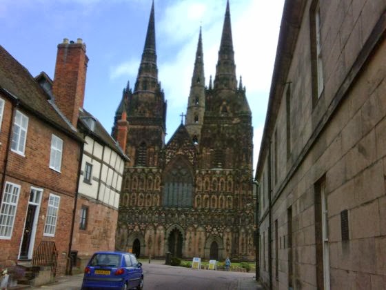
LICHFIELD CATHEDRAL'S THREE SPIRES
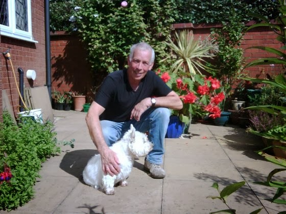
MIKE AND TOMMY (TOMMY HAS FOUR LEGS)
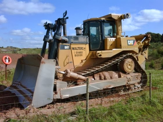
MAGNIFICENT MACHINE AT HINTS GRAVEL PIT
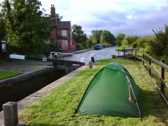
CAMPED NEAR DOG & DOUBLET
BROKEN POLE - BROKEN HEART
KINGSWOOD CANAL JUNCTION
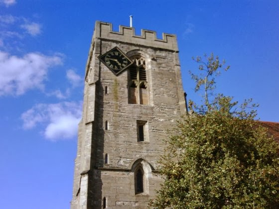
ST. JOHN THE BAPTIST CHURCH, HENLEY-IN-ARDEN
Shortly after I woke up in the garden of The Park Gate Inn, Louise, who had arrived to perform her cleaning duties, opened the back door and brought me a coffee. 

By 8.30pm I was back on the Heart of England Way (HoEW), although I didn't follow it very precisely because it seemed to head off in some daft directions for no obvious reason other than to add distance. I arrived in Lichfield before 11.00am and was immediately impressed by the Cathedral's three spires: that's just greedy, isn't it? I really liked Lichfield. It had a good feel to it. 

After scoffing a Boots 'Meal Deal', I walked through a housing estate to the south of Lichfield and found myself talking to Mike, who interrupted his gardening duties to invite me in for coffee. The weather was the best I'd seen for a while, so I dug out the neglected sunglasses and rubbed on the sun screen while we chatted on his patio.

I reached Drayton Bassett just after 4.00pm with the expectation that I could get a refreshing drink. I noticed a banner saying 'Garden Now Open' but couldn't see any obvious signs of an associated drinking establishment. Some chatty locals assured me that there definitely was one, but didn't seem to know when it opened.

Rather than lose more time, I continued south, ambling my way along the towpath of the Birmingham and Fazeley Canal until I reached the Dog and Doublet pub. It's location by a canal lock was idyllic. I erected my tent on the other side of the lock and then ordered my food, which I ate outside in the evening sun.

I got to sleep early because the following day, 8 September, I needed to be clear-headed for my 6.45am live telephone interview with Julian Clegg on his BBC Radio Solent Breakfast Show.

Afterwards, Jim, landlord of the Dog and Doublet, opened his doors early to let me into the pub and gave me coffee and a huge egg and bacon sandwich to set me up for the day.

I continued alongside the Canal, picking up the HoEW again, then switching to the Centenary Way, then back to the HoEW. Even I'm getting confused now!

I left both designated footpaths completely to visit Meriden, where the original Triumph motorcycles were made, including the T110 that I owned when I was 17. Ah, nostalgia. I wanted to pay homage at the site of the old factory, but it turned out to be 2 miles to the east of the town. I wasn't that nostalgic, so I headed south to rejoin the HoEW near Berkswell.

That was when it happened. Tragedy. I noticed that one of my trekking poles was bent, so I tried to ease it straight again. "I didn't mean to do it; honest Guv, it just fell apart in me 'ands." Normally, such a dramatic shock would spontaneously produce some profane utterance. But no, not me, not now, for my walking experiences have helped me to develop an inner calmness, and the ability to think before I speak. So I thought about it and then uttered a profanity.

Obviously, I can live without the broken pole. I have completed two thirds of my walk and the remaining third is relatively flat. However, I will miss it because I have gotten used to it, and having two poles does take some of the pressure of the heavy rucksack off of my knees.

I continued my way, heartbroken, to a pub called Ye Olde Saracen's Head in a village called Balsall Street. Manager Brett cheered me up when he let me pitch my tent in the garden and eat two main meals for the price of one. Burp.

The weather has been great again. My feet are dry and I'm running out of sun screen.

I slept late on Wednesday morning waiting for the Saracen's Head to open (sounds messy, that). A nice surprise awaited me when Brett gave me a coffee and a comprehensive packed lunch for the day. I followed the HoEW for a short while, but then deviated onto the towpath of the much more interesting Grand Union Canal. This led to the fascinating lock system at Kingswood Junction where the Grand Union meets the Stratford-upon-Avon Canal.

I enjoyed chatting to several canal-boaters as I continued down the Stratford Canal, but had to slow my pace so they could keep up with me. The kind owners of 'Rick o'Shea' gave me a cold lager, which was most welcome in the heat of the day.

After a short distance I picked up the HoEW again which would take me to Henley-in-Arden. Just before I got there I crossed a hill, which was called Motte and Bailey on the map; clearly named after a comedy duo!

I stopped briefly in the main street of Henley-in-Arden for an ice cream and a cider, and noted the unusual lozenge-shaped clock attached asymmetrically to the tower of the St. John the Baptist church (see picture). Can't understand why the fifteenth century church builders didn't anticipate this requirement and leave a proper space for it.

Since it was only 5.00pm, I decided to walk on a bit further. Big mistake, as I ended up in the small village of Great Alne. Whatever great ambitions this place might have had were clearly unrealised. The only pub in the village, which went by the peculiar name of 'The Mother Huff Cap', was in a severe state of decay. A caretaker manager was in place while the owners sought a buyer, so there was no food available. I was at least able to console myself with a drink and a chat with some locals before I retired to my tent, pitched in the unkempt garden.

Sunday, 6 September 2009

OSGB GRID REF. SK045125 CANNOCK WOOD

JIM TAKES ME BACK TO CASTLETON
CAMPING NEAR UTTOXETER IN FARMER'S GARDEN
PRIZE-WINNING LOO IN UTTOXETER
YOU'RE NEVER ALONE IN THE COUNTRY
HEAVY TRAFFIC ON THE FOOTPATHS
BOATS ON BLITHFIELD RESERVOIR
It was Friday 4 September and, although I woke up at 6.00am, it was late morning before I was ready to leave Sheffield because I wanted to finish and transmit my blog text while I had an excellent connection. Jim was very patient. When I was done, he delivered me back to the same location in Castleton where he had picked me up on Tuesday. This was just in time for me to start walking at midday.

The day had started with a few promising rays of sun, but my cynicism compelled me to wear my waterproofs anyway. Good call, because it was raining within 10 minutes of me leaving Castleton. My southerly route was via the Limestone Way. I soon discovered that care was needed because my boots (Brasher Hillmasters) tended to slip on the wet limestone path as I climbed through Cave Dale. This problem was soon replaced by another when I found that the next section of the path was shared with cattle, lots of them, and was a total quagmire

Progress quickened significantly once I found myself on some minor tarmac roads and then a disused railway track now designated National Cycle Network route No. 68. The light fades earlier in the evening now, so I really need to consider finding a suitable place to pitch my tent by 7.30pm. It was gone 7.00pm and I fancied a drink. According to my map there was a PH (Public House) close by in the village of Biggin, just off my route. When I reached what turned out to be the Waterloo Arms, not only did they serve alcohol, but also substantial meals at sensible prices and, wait for it, they had a campsite in the back garden for which they didn't charge me. Truly, a backpacker's paradise!

When the hangover wore off in the morning (only joking), I returned to the cycle path. I speed-marched the 6 miles to Tissington, dodging the Saturday morning cyclists and stopping briefly for tea and cakes at the Tissington Hall cafe. I shared a table with a lady named Helen and her two dogs, and enjoyed a pleasant conversation with her. The dogs didn't say much, but looked at me lovingly as I ate.

On leaving Tissington I rejoined the Limestone Way and proceeded to Ellastone. The walk was pleasant, but uninspiring, and when I got to Ellastone I just carried on through as I couldn't find anything interesting enough to persuade me to stay.

Next stop was Rocester, where I purchased something for supper in the local store and enjoyed an hour or so chatting to, and accepting donations from, customers at the Red Lion pub before I continued my way towards Uttoxeter. Since the Limestone Way misses the centre of Uttoxeter, I walked on the generous verge alongside the B5030 instead, eventually camping in a Farmer's garden (with his permission) a mile north of the town. Oh, and for once I had a rain-less day!

I continued into Uttoxeter in the morning and had breakfast at a Subway in the town centre, the only place open on a Sunday, and used the local facilities (code for loo). I discovered a spotlessly clean place with pictures on the walls and ornaments on the shelves that had repeatedly been voted 'Loo of the Year'.

The Limestone Way ends at Uttoxeter, but the Staffordshire Way starts there, so I headed south along the latter. The walk was relatively flat and representative of the 'typical English countryside' one sometimes hears described. The morning was warm and involved walking through both horticultural and agricultural farmland. Farmer's waved as they drove by on their tractors. No rest day for them on the Sabbath when the crops need harvesting.

I arrived at the Coach and Horses pub in the village of Abbots Bromley at 1.00pm, and they served me an excellent roast beef dinner. Due to my high calorie burn I have lost several inches off my waist since I started this trek, so I take every opportunity possible to eat.

Next, I headed in the direction of Rugely, briefly stopping to watch the boats on the Blithfield Reservoir. Leaving the Staffordshire Way as I crossed the River Trent, I passed though the west side of Rugely and stopped to send some emails at The Horns Inn pub in the unusual sounding village of Slitting Mill. The staff there took a particular interest in my trek and said that they would collect for the charities on my behalf. Brilliant! We did a photo shoot at the front of the pub before I left, which was all too soon, but I needed to cover a few more miles before nightfall. Pity, because I would have loved to have remained longer with such a friendly bunch.

I cracked on through the forest to the south of Rugely until I joined up with the Heart of England Way, and this led me to Cannock Wood. Light was fading and there had been a light shower, so I popped into The Park Gate Inn and asked Steve Donnor, the manager, if I could camp in the garden. Permission was granted, so I was sorted for another night.

If this sounds a bit of a pub crawl, then I suppose it is. Then again, part of the purpose of a pub is to provide a refuge for itinerants like me! In any case, I never drink so much that I forget which way is south. Hic.

Thursday, 3 September 2009

OSGB GRID REF. SK355861. SHEFFIELD

ROCKY VIEW NEAR STANDEDGE
FELLOW JOGLERS JAS & STU
AFFECTIONATE ROCKS - THE WAIN STONES
LUNCH TIME WITH STU & JAS
ME BEING A HERO AT KINDER LOW
HELPING PETER AND JIM ON MY REST DAY
Someone was aware that I was sleeping on North West Water property because, when I exited the tent in the morning, I noticed that the previously closed gate had been latched open! The rain had ceased and the fog had cleared so, with plenty of daylight hours ahead, continuing across the moor was no longer a concern.

Some 8 miles to the south, near Standedge, I met Australian couple Stu and Jas who also happened to be walking from John o'Groats to Land's End. After 5 years of working in London, they had put their careers on hold and their possessions in storage to pursue this adventure. They are raising money for the Alzheimer's Society and although their progress had been slower than mine, in many other respects their route objectives were remarkably similar; avoiding roads, wild-camping and following unmarked trails through the wilderness areas of Scotland.

It was great to have some company as we walked together, assisting each other with navigation. I ended up some distance ahead when they got chatting to another walker near Black Hill, but we got back together again at the campsite in Crowden, our final destination for the day. We had plenty of information to share as we ate our suppers together.

We were greeted by the sun on Tuesday morning, enabling me to dry some of my damp gear at last. Completion of the Pennine Way was now in sight. Edale, the southern end, was just 16 miles away so we expected to get there by early evening. Stu and Jas left the campsite first with the expectation that I would catch them up later that day because I was a slightly faster walker. They lost time after making a significant route-finding error, however, so I caught them much sooner than expected, just south of Bleaklow Head, where the fascinating 'kissing' Wain Stones are located (see picture). We remained in sight of each other for the remainder of the walk, although I hung back to don my waterproofs when I saw the huge black storm clouds awaiting us on our approach to the Kinder Scout plateau. Just as well for me, for when the thunder and lightning started, Stu and Jas were right in the thick of it. Being on the hills in an electrical storm can be very dangerous, with Stu later expressing his concern at being so close to the centre. I wasn't too thrilled at the prospect of seeing my new friends getting toasted either.

The brief storm passed and we continued our walk around Kinder Scout's western peripheral ridge, passing Kinder Downfall where the channelled wind was driving the waterfall upwards, against gravity, and deviating from the path a little to visit the moon-landscape which is the summit of Kinder Low. The final decent down Jacob's Ladder eventually led us to the traditional end of the Pennine Way, the Nag's Head Inn in Edale. We all shared a brief celebratory drink and exchanged contact details before I had to say farewell, hoping that we might meet again further south. I had arranged to meet my friend Jim at the Peak Hotel in Castleton, and this required me to cross one further hill before it got dark. Jim was there waiting when I arrived a little before 9.00pm and we drove directly to the comfort of his home in Sheffield, where I would spend a couple of rest days.

Jim had brought a box of my spare equipment to Sheffield, so I was able to exchange my worn Scarpa boots for a pair of nearly new, but worn-in, Brasher Hillmasters. I also had the opportunity to review what else I needed for the remainder of the walk and dispense with anything I could do without. I decided that in the well-populated south, and given the summer temperatures, I could do without the cooking stove and its associated gas. I also exchanged the Katadyn water filter for a simpler filter bottle given to me by Pure Hydration.

During my stay in Sheffield Jim introduced me to some of his friends. On Wednesday I helped him and pal Peter move a large machine tool to Peter's house. During the car journey, Peter, a keen and knowledgeable local historian, educated me about Sheffield's industrial history. At Jim's local Social Club I was introduced to businessman, motorcyclist and runner Michael Wright, who made a very generous donation to my charities. Thanks Michael. I'll do my best to keep up the literary standard for you.

The break gave my feet a chance to recover from having been in damp shoes and socks for several days, as they looked like they were suffering from the first stages of trenchfoot. Jim's kind attention had restored me both physically and psychologically, but all too soon it was time leave. However, as I prepared for bed on Thursday evening, I felt enthusiastic to restart my southward journey next morning.

Sunday, 30 August 2009

OSGB GRID REF. SD969179 BLACKSTONE EDGE

THE STEEP END OF PEN-Y-GHENT
MALHAM TARN
RIVER FROM NOWHERE - MALHAM COVE
BARGES ON LEEDS & LIVERPOOL CANAL AT GARGRAVE
SOME SHEEP ARE UGLIER THAN OTHERS
'WUTHERING HEIGHTS' PLAQUE AT TOP WITHINS
Typical, isn't it. I climb the 3-Peaks and it rains all day. I spend a rest day indoors talking to John Manning and the weather is fine. Now, Friday 28, I'm continuing my walk and it's raining again! At least visibility is good enough to actually see the summit of Pen-y-ghent this time as I pass it on my way south.

Other than stopping to chat to a few people as we pass, the walk is quite ordinary until I reach Malham Tarn Nature Reserve with its beautiful vistas comprising a wonderful interplay of water, limestone crags and trees. Exposed limestone features strongly in the landscape here, and as I continue south I pass though the rocky Ing Scar valley and walk across a natural limestone pavement until I reach the dramatic sheer walls of Malham Cove where, like magic, the river flows out from under the base of the cliff.

I'd expected to pick up some food for the evening in Malham village but had dawdled so much that it was just after 5.00pm when I arrived and only the pub was open, and they didn't serve meals until 6.00pm. They did have a sandwich and a pasty available at the bar, though, so after washing these down with a Strongbow cider, I continued my trudge south. I found an ideal wild-camping spot in an animal-free field just as the light was beginning to fade, and erected my tent quickly in the rain.

My camping spot was just a mile north of Gargave, so in the morning I strolled down to pick up some supplies in the local Co-op and have breakfast in the Dalesman Cafe, where several folk gave me money for the charities. These shops would be the last I would see during the day. As I passed through Thornton-in-Craven, Lothersdale and Ickornshaw, the initially promising weather deteriorated into rain again. It was a shame because in dry, clear conditions these rolling hills with potentially good views would have provided a much more pleasant walk.

Crossing boggy and exposed Ickornshaw Moor in heavy rain was, quite frankly, miserable. I was glad to get across it and down to the safety of Ponden Reservoir. The light was disappearing fast by then and the ground around the Reservoir sloped steeply, but after stepping over a fence into the grounds of the local Boat Club I found a level plot suitable for the tent. I'm sure they wouldn't have minded had they known. The rain beat down heavily on the fly-sheet as I took off all my wet gear before getting my head down.

The morning of Sunday 30 August was another soggy one and the prospect of better weather seemed unlikely. After warming myself up with a cup of hot coffee, I put all my wet gear back on whilst flicking off, from the inside of the tent, all the slugs I could see crawling up the transparent inner sheet. One slug had slithered its way right up to the apex. I find it remarkable that a slug should go to all this effort when there is no food to be had at the top. Perhaps, like us, they sometimes feel compelled do things 'because it's there'.

The walk south took me into heather covered moorland again, but not with the same cold and sinister feel as Ickornshaw Moor. I am in 'Bronte country', and arrive shortly at the ruin of Top Withins, said to have been the inspiration for Emily Bronte's 'Wuthering Heights'. Further on I came to the three Walshaw Dean reservoirs and turned south at the middle one, temporarily leaving the Pennine Way. My reason for this is that I need to resupply with food for the next couple of nights using the ample facilities at Hebden Bridge, which the Pennine Way skirts around. My detour took me across Walshaw and Lancashire Moor, and past Hardcastle Crags.

Hebden Bridge is an old Mill Town, once prosperous because of the cloth trade. With its railway, canal, tall chimneys and terraced houses, it still has the appearance of a town created in the Industrial Revolution, which I rather liked.

Having completed my shopping and consumed a tasty take-away of Haddock and Chips, I continued on, rejoining the Pennine Way a mile south of the town. However, the weather started to deteriorate badly again. I could barely see the monument atop Stoodley Pike, and walking alone on the raised bank alongside the Warland, Light Hazzles and Blackstone Edge Reservoirs was spooky because all I could see was the cold black water which eerily seemed to beckon me to “come in, come in” !!!!!

At last I reached the A58 which cuts straight through the moors. It was 7.30pm by then and I decided that, with darkness approaching, to continue my walk over the exposed moorlands in thick fog and driving rain would be both dangerous and foolish. I therefore climbed over the fence of the North West Water compound opposite the White Horse pub and encamped there. As I lay in my tent, I had to admit to myself that the consistently poor weather was beginning to depress me. What I desperately needed was some more sunshine in my life.

Thursday, 27 August 2009

OSGB GRID REF. SD812721. HORTON IN RIBBLESDALE (STILL)

THE REMARKABLE WESTBY FAMILY
THE PEN-Y-GHENT CAFE
RIBBLEHEAD VIADUCT
SHELTER ON SUMMIT OF INGLEBOROUGH
TRIG POINT ON PEN-Y-GHENT
JOHN MANNING CHECKS MY KIT
Having completed my report for Tuesday 25 August, who should I meet in the late afternoon but the same family from Kent that I tagged along with on my departure from Bellingham the previous week. I am pleased to see them again and get to know their names this time. I think it truly remarkable that Mum and Dad, Heather and Andrew Westby, have three teenage children, David, Sarah and Timothy, who are equally enthusiastic about taking on the onerous challenge of walking the Pennine Way, which includes camping overnight. I later enjoyed sharing supper with them at the Crown Hotel. When we said our goodbyes I was sad that I would not be meeting them again since they would be continuing along the Pennine path while I stayed to climb the Yorkshire Three Peaks.

Just as a reminder for those following this diary, the Three Peaks Challenge involves summitting three local mountains, Pen-y-ghent, Ingleborough and Whernside, totally on foot and all within a 12 hour period. They are separate mountains, so it is necessary to descend each before climbing the next. They can be done in any order and by any route, but the total distance involved generally ranges from 23-26 miles.

The Challenge starts and finishes at the Pen-y-ghent Cafe in Horton, so I rose early on the Wednesday morning, picked up the packed lunch Cynthia had left out for me and posted a note through the Cafe door registering that I had started at 7.38am. The weather was appallingly wet and I wished to avoid bogs as far as possible, so I chose to walk directly to Ribblehead Viaduct by road and start climbing Whernside, the most distant from Horton, first.

The wind-blown rain stung my face and soon penetrated my waterproofs, so I had to keep moving in order to keep warm. I was soon in dense cloud - so dense in fact that I walked straight past the trig. point on Whernside's summit without even seeing it.

Next, I dropped down to the valley and then started ascending Ingleborough, a steeper climb than Whernside but along a well-maintained path with steps that take you right up to the mountain's flat top. The descent back to Horton was long and slow, and the path quite slippery with mud in places. I made a silly route-finding mistake in the poor visibility which cost me 20 minutes, but had now cracked the greater part of the Challenge.

Although Pen-y-ghent is the most well-known of the three mountains, it is actually the most diminutive. Since it is also the nearest to Horton, I expected to dispatch it quickly. And so I did, although my hope that the weather would improve by the time I got to it was not realise. Pen-y-ghent translates to 'Hill of the Winds' and it certainly lived up to its name. The rain had been relentless, so by the time I returned to the Pen-y-ghent Cafe at 4.32pm I was wet through. I had completed the Challenge in a respectable 8 hours and 54 minutes, well below the 12 hour maximum. There was no hanging around to savour my success, though. I was getting cold now I'd stopped moving, so it was back to Broad Croft House to enjoy a hot shower.

You may well ask, what was the point of me undertaking the Challenge on a day when conditions were so utterly miserable and there were no views to be enjoyed? Well, other that avoiding any slippage of my schedule, friend Kay, who has been working so hard to publicise my venture, recently suggested in an article that I could be described as 'interesting, but crackers'. I will leave people to make their own minds up about the former, but I think I might have to concur with her on the latter.

It occurred to me later that I hadn't even thought about my shin-splint injury for a couple of days, so I think we can pronounce that one 'sorted'. I'd better send a thank you text to Reiki therapist Annabel in Bellingham.

Thursday 27 was another rest day, except that Rob had arranged for me to be interviewed by John Manning, a former Deputy Editor of walker's magazine TGO (which stands for 'The Great Outdoors') who now writes articles freelance. John was very easy to talk to and we spent more than 4 hours discussing my trek before he decided that he had sufficient material. It would clearly benefit us both if his efforts were rewarded by a published article.

Afterwards, I walked to the Crown for supper. During the evening I discovered that the couple sitting opposite, Margaret and Ray, lived in Fareham, just a few miles from my home. Moreover, they happen to be good friends of my neighbours. Small world, ain't in?

Anyway, following Wednesday's drenching, Cynthia has dried all my kit, thereby removing the only excuse I could think of for not continuing my walk tomorrow. It looks like my pleasant stay in Horton is coming to an end.

Tuesday, 25 August 2009

OSGB GRID REF. SD812721. HORTON IN RIBBLESDALE

MIDDLETON-IN-TEESDALE
GOD'S BRIDGE - A NATURAL LIMESTONE BRIDGE
THE TAN HILL INN - HIGHEST IN BRITAIN
'HIGH FORCE' FOLK MUSICIANS
MY WIND-BLOWN CAMPSITE BY GREAT SHUNNER FELL
THE CROWN HOTEL
THE GOLDEN LION
ST. OSWALD'S CHURCH IN HORTON IN RIBBLESDALE WITH PEN-Y-GHENT BEHIND
Well, best laid plans, and all that. I had intended to leave Middleton-in-Teesdale by 4.00pm at the latest but I made the mistake of writing my diary in a pub. Then I got chatting to a group of ramblers; nice folk who gave me some cash for the charities. Then one of them bought me another cider. You know what it's like. By the time I left it was well past 6.00pm. I still had to transmit the diary and the pictures to webmaster Simon, and planned to do this when I had climbed out of the town, guessing that I would get a better connection higher up. By the time I had done this there was no chance whatsoever of me achieving my 8 mile target before nightfall.

I walked as fast as I could, but wasted time by making route-finding mistakes that cost me another half hour. Must have been that cider. I managed about 5 miles before the light became too poor to see adequately. Unable to find anything better, I pitched the tent by torchlight at the edge the path running around the western end of Blackton Reservoir.

Rising early next morning, I was on my way before 8.00am determined to make up for the previous day's mileage shortfall. Ahead of me were many miles of moorland peat bog to squelch through. The featureless terrain made route-finding tricky and I often had to rely on signs of disturbed grass for guidance. It occurred to me that I could easily be following someone else's mistaken route and end up walking into the same bottomless hole, to be preserved in peat forever.

After 5 hours of trudging a reward awaited me, for I had reached the Tann Hill Inn, the highest Inn in Britain. Being a Sunday it was busy, but not too busy to provide me with a terrific Sunday lunch, served in a huge Yorkshire pudding of course. Live music from a group of talented folk musicians called 'High Force' made the meal even more enjoyable, and I could easily have settled there for the afternoon, especially since the rain had set in. I sat opposite a charming couple called Quinta and Hanspeter. Quinta asked me to sign one of my 'steveslongwalk' mini-posters for her, and I obliged. I still had many more miles to cover, though, so with great discipline I donned my waterproofs and reluctantly left the Inn at 3.00pm to continue south, initially to Keld, and then to Thwaite via the North Gang Scar, enjoying the wonderfully picturesque valley views to the east.

It was a little past 6.00pm when I stopped by the Kearton Country Hotel in Thwaite to make some telephone calls (mobile communication being non-existent), have a drink and to buy some chocolate bars. With my present energy expenditure I can eat chocolate bars with complete abandon and still not gain weight. Doesn't that make all you chocoholics feel really jealous?

After consulting with a local chap, I decided to continue west out of Thwaite and climb towards cloud-covered Great Shunner Fell. The plan was to reach a plateau, part-way to the summit, where I thought I could camp. That way I could reduce the following day's distance.

The plateau was at an altitude of 597m and I reached it while the light was still good, but had to search for a plot of ground that was not boggy and had some degree of shelter from the strengthening wind. The best I could find was on the lee side of a rift in the peat. I had to hold on to the tent firmly as I assembled it otherwise it might have taken off like a kite. I pegged it down well, but it still bucked, writhed and twisted all night in response to the violent wind. However, the tent had been made to withstand such conditions, so I was not too concerned and slept reasonably well.

By morning the wind strength had reduced, easing the dismantling the tent. It was overcast, but the sun was doing its best to break through. The summit of Great Shunner Fell was visible, at 716mn just a mere 119m above me, so it didn't take me long to reach it. I then descended the long path down into Hardraw where I was astounded to meet Quinta and Hanspeter once again, sitting with another friendly couple outside the Green Dragon pub. Quinta had me sign her poster for a second time.

I needed to keep moving, though, and proceeded to Hawes where John, at the local YHA Hostel, assisted me with booking accommodation in Horton in Ribblesdale, my final destination for the day. This would be the 600 mile, or half-way point of my walk, where I had scheduled some rest time for myself. I had to get there first, of course, which involved a 13 mile route-march, during which I paid little attention to anything other than the growing ominous presence of Pen-y-ghent and the stony path of the final couple of miles which made my feet very grateful to have arrived.

I spent the evening at the Crown Hotel, enjoying their steak and mushroom pie with lots of vegetables, and chatting to fellow Pennine walker Keith.

The Crown could only accommodate me for that one night, so next morning, Tuesday 25, I moved all my stuff to Broad Croft House at the other end of Horton in Ribblesdale, where I would stay with hosts Cynthia and Rob for the remaining 3 nights.

Tuesday was spent exploring the village, and visiting it's establishments. I chatted to a couple from Oxford in the Golden Lion pub who very kindly bought me lunch and a beer. This would certainly help to build my strength up, since I intended to undertake the Yorkshire 3-peaks Challenge the following day and the weather forecast was not looking particularly good.