Friday, 7 August 2009

OSGB GRID REF. NT276730. ARTHUR'S SEAT, EDINBURGH

UPPER GLENDEVON RESERVOIR
PATH? WHAT PATH?
THE BEAUTIFUL OCHILS
SEWAGE WORKS CAMPSITE
A BRIDGE TO NOWHERE
WEST FIFE CYCLE WAY INTO DUNFERMLINE
TWO GREAT BRIDGES
SARAH AND FINGAL AT ARTHUR'S SEAT
I was exhausted when I reached the Blackford Hotel after my 'walk too far' from Muthill. After two pints of soda water and lime to rehydrate myself, I had a shower and went straight to bed. My sleep pattern was disturbed and I woke up every few hours, but finally arose at 7.00am feeling fine. A good breakfast made up for the omission of the previous night's supper. The hotel staff knew that I had really wanted a room with a bath in which to immerse my aching feet and legs. None had been available at the time, but they kindly cleaned the bathroom of a room vacated by another guest early in the morning and allowed me to have a good long soak.

Suitably recuperated and with diary writing duties completed, I hobbled off south across the Ochil Hills in the direction of Tillicoultry, taking care not to jar my right leg too much. A path was marked on the map and, amazingly, one existed on the ground, although sometimes so indistinct I wondered if you really needed Scottish blood in you to see it. There was even an occasional sign or style to reassure me I was on the right track. It was T-shirt weather and the walk can be counted amongst the most pleasurable to date. The views of Upper Glendevon Reservoir and the steep-sided Ochil mountains were breathtaking, so I was happy to take my time. When I reached the top of Skythorn Hill, I was simultaneously excited to see the Lowlands ahead and sad that I would now be leaving the last vestige of the dramatic Highlands behind me.

After the final descent into Tillicoultry, I found a pub for the obligatory 'end of walk' beer and, with the help of a local, identified a place to pitch the tent - right next to the local sewage works. The complete change of environment had been remarkably rapid.

My right shin was quite swollen, but this had largely subsided by morning. I thus prepared my maps, broke camp and headed off for Dunfermline. It was a beautiful sunny day. I had walked for little more than a few minutes before I came to a place called the Community Internet Cafe Society. I popped inside for a cup of tea and to check my webmail. Polly, working there, saw my rucksack banner and took some mini-posters so that she could do some promotion on my behalf. For the third time to date, I left without paying, but this time at Polly's insistence. I will put another £2 towards the charities anyway.

I continued my walk past Gartmorn Dam to join another disused railway track near Clackmannan. Given my earlier experience with a disused railway track, I was cynically expecting this one to be yet another impenetrable mass of foliage. Not so. This was a full-blown tarmac expressway for cyclists, renamed the West Fife Cycle Way, and leading all the way into Dunfermline. There were even signs at kilometre intervals informing me of the remaining distance. I was able to maintain one kilometre every 12 minutes, even with the shin-split injury. There were, however, two negative factors about this path. Firstly, it is straight, uniform, lined with head-high foliage and really boring. Secondly, almost all the other users were on two wheels and whizzed past with their eyes firmly focused ahead, generally too frightened of falling off to give even a wave. With this lack of either visual interest or social interaction, I just put the headphones on and listened to music from my portable stereo as I walked.

When I arrived, Dunfermline seemed like many other towns and I wasn't inclined to stay. It was getting late so I needed to get out of the centre anyway to find somewhere to pitch the tent. I walked right through the town to the other side and, as luck would have it, came to a 24-hour Tesco where I could resupply right next to a sports field where I could camp.

Next morning, I joined National Cycle Network route no. 1 which would take me into Edinburgh. I picked up some anti-inflammatories for my leg from a pharmacy in Inverkeithing and stopped for lunch at the viewing platform just south of the Forth, which gave me time to admire the two magnificent bridges crossing this huge river. The contrast between the massively over-engineered but incredibly strong cantilever railway bridge completed in 1890 and the more delicate looking suspension road bridge opened by the Queen in 1964 is remarkable.

The final walk into Edinburgh was uneventful. I arrived at a car park near Holyrood House to be met by Sarah and her cocker spaniel Fingal. Sarah had offered me accommodation in Edinburgh after hearing of my trek through a mutual friend. We walked up to Arthur's Seat together, which delighted Fingal. The weekend was the start of the Edinburgh Festival so I could not have timed my arrival better.

Tuesday, 4 August 2009

OSGB GRID REF. NN897089. BLACKFORD

BEN LAWERS SUMMIT
MATHIEU AT BRAVEHEART BACKPACKERS HOSTEL
FALLS OF DOCHART AT KILLIN
RAILWAY PATH - TRY LIMBOING UNDER THIS IN A RUCKSACK
WATCH ME WAGGLE MY EARS - DONKEY HUMOUR
Anticipation of the Ben Lawers climb and the coldness of the concrete-floored Visitor Centre got me out of my sleeping bag early. Breakfast comprised of some chocolate marshmallows I had bought in Bridge of Gaur, washed down with stream-water tea. I had brought a lightweight day sack with me and packed it with the usual hill-walking essentials: spare clothing, navigational aids, food and water, first aid kit, etc. With my main rucksack secreted behind a display stand at the Centre, I started the ascent.

It was 8.00am Sunday, and two couples had arrived in cars to undertake the climb themselves that day. Without the impediment of my usual weighty load I moved fast and was soon above them. My ascent was to be via the 3,619 foot summit of Beinn Ghlas, nearby. Once I had penetrated the cloud-base, visibility was greatly reduced, and it was eerily silent as I walked alone along the ridge that connected the two mountains. All this changed when, after a final steep climb, I reached the 3,983 foot summit of Ben Lawers. The bitterly cold wind was easily powerful enough to knock me onto my knees. After taking a photograph of the trig point and its companion cairn, I made my way back down via a more gentle path that contours around Beinn Ghlas. I was down by 11.00am so the whole event had taken just 3 hours, which included time spent chatting to other walkers.

The subsequent road walk to Killin was probably more hazardous, but I was courteous enough to wave to drivers who made obvious attempts to avoid me. In Killin I discovered the Braveheart Backpackers Hostel, supervised by Frenchman Mathieu, who was using the job as a means to improve his language skills.

My right leg was hurting again, this time at the front; probably a shin-splint. My right calf had also been suffering mild pain for few days, but I concluded that it was merely jealous of the attention the left one, now better, had received. Ignoring these injuries, I decided to continue walking the next day.

The fine weather of Sunday 2 did not continue into the Monday, so it was wet gear all the way. I started late because of diary-writing duties, and then made a navigational error that cost me an hour. As on Saturday last, I had to cross over a mountain between two path ends, but the mountain was lower, the distance was shorter and I was now more experienced. My navigation was spot-on, and I was on the outward path within an hour. It was starting to get late, so I tried to short-circuit a hairpin in the path only to discover that its purpose was to avoid a ridge, which I then felt compelled to climb down. My legs complained at this and, as it was nearly 9.00pm, I decided to camp at the southern end of Loch Lednock. It's no fun pitching a tent in the pouring rain.

It's even less fun packing it away in the pouring rain next morning, after having to put all yesterday's wet clothes back on again. My son, David, has joined the Territorial Army, so will have plenty of this to look forward to.

Initially, I headed for Comrie to buy some more food. I then attempted to find the path that follows the disused railway line which, I thought, would take me into Crieff. I quickly found out that the rules about footpaths I learned earlier still apply in a semi-urban environment. Just because a path is shown on the map, don't assume that you can follow it. Yes, the old railway line did exist, but parts of it were now private land and other parts were impassable because of foliage or because bridges over streams had gone. After bashing on for 3 hours, in which time I covered only 3 miles, I gave up and found myself a maintained path which enabled me to cover the next 3 miles in just 1 hour. This was in spite of my injured legs which, to an observer, would have probably made me look like a prime candidate for John Cleese's Ministry of Silly Walks, for those old enough to remember the sketch.

Crieff looked interesting, and I will put it on my list of places to visit in the future, but the walk from Comrie had taken longer than expected, so I continued on southwards to Muthill (pronounced Mooth-ill), which involved a walk alongside the A822. I thought that its straightness might make it safer, but car speeds were inevitably higher and drivers could now line me up in their sights earlier.

Since Crieff to Muthill had taken me one and a half hours, I thought that the similar distance from Muthill to Blackford would take similar time, getting me there by 8.00pm. Big mistake! The rule about paths and maps kicked in again. In fact, I found rather more paths than the map said which served to confuse even more. However, the state of most of the paths was dreadful, being overgrown, hard to recognise and with little signposting. One section took me though a field occupied by a large bull with huge, very sharp looking horns. He lifted his tail and started stomping his feet when he saw me, thinking perhaps that I was interested in his two attendant cows. I gave him a very wide berth, putting on an act of nonchalance as I walked briskly to the exit gate.

A new golf-course development had totally obliterated the final mile of footpaths into Blackford. My patience snapped at this point. I climbed over the gate and walked straight across it to arrive, completely shot-away, at the reception desk of the Blackford Hotel. It was 9.30pm, so at least I got a late booking discount. Shot-away later turned out to be quite an apt description of my physical state as the golf course developers apparently have a habit of shooting blanks above the heads of trespassers.

Saturday, 1 August 2009

OSGB GRID REF. NN609379. BEN LAWERS VISITOR CENTRE

FREDDIE THE MOUNTAIN BIKER
BOTHY AT LAIRIG LEACACH
VIEW FROM CREAGUAINEACH LODGE
DUTCH VISITORS TO CREAGUAINEACH LODGE
LOCH TREIG
CORROUR STATION
WHERE THE RUCKSACK DISASTER HAPPENED
HYDROELECTRIC DAM NEAR BEN LAWERS
Shortly after leaving Spean Bridge I turned south through the tree-line to have the most wonderful vista of mountains and valleys open up to me. These were real Scottish mountains; Munros of 3,000 feet and over. Even the valleys were elevated to over 1,000 feet. I climbed steadily into them throughout the late afternoon and evening. Occasionally I would see the boot print of another walker in the mud, evidence that this wilderness is not quite so remote as the Flow Country, but the only other soul I met was a mountain biker named Freddie. I came to a mountain bothy at Lairig Leacach, but walked on as it was too early to stop. The earlier mixed weather had settled, and I was able to bathe in the radiant warmth of the evening's low sun. I continued alongside the beautiful waterfalls of Allt na Lairige until I spotted Creaguaineach Lodge, sitting on a grassy ledge at the southern end of Loch Treig. The young deer grazing nearby spotted me first and had run off by the time I reached it. The Lodge was apparently unused and sealed with padlocks, but I was content to pitch my tent on its eastern side.

I was in no hurry to leave the following morning. I took so long to get ready that, just as I lifted the rucksack onto my back, a group of Dutch hikers appeared. They had been staying at the Youth Hostel, one and a half hour's walk away, and were on their way to Spean Bridge. They were without a camera, so were pleased when I took some photographs.

My next destination was Corrour Railway Station, apparently the highest and most remote in Britain, yet civilised enough to provide me with lentil soup, carrot cake and tea in the adjacent cafe. Since there are no roads, I assume the staff must take the train to work. I had walked on for some distance before I realised that I had not paid, again, this being the second time in a week. They had even been kind enough to display a mini-poster about my trek. My reputation for dishonesty coupled with that for stupidity in publishing these misdemeanours must be growing steadily. I have put £8 into the charity fund on the cafe's behalf, but if they contact me through my web page with the necessary details I will send them a cheque.

 My path took me across the hills in a south easterly direction. It started to rain. Taking off and putting on the rucksack is no trivial task, so I had already donned my waterproof jacket as a precaution. However, by the time I put on my waterproof trousers my lower half was already thoroughly wet. The waterproofs do prevent the wind making me cold and, being breathable, my inner clothing still dries. Clever stuff. 

I eventually reached a road that took me to my overnight stop at Bridge of Gaur (pronounced Gower). I erected my tent on the manicured lawn in front of the tin-shack School House. Being Saturday tomorrow, I wasn't expecting an early morning wake-up call from the local satchel-squad. Other than a few houses, there seemed to be little else in the village. No shop. No pub. Good job that I had brought my own supply of whisky in an old plastic soap bottle.

Up and away early next morning, I continued walking south until the hill track came to an end. The next track, which would take me into Bridge of Balgie ('g' pronounced as in 'good grief') started two and a half miles away as the crow flies. In between, there was an 862m mountain called Cam Chreag. I could either embark upon a long and boggy trek around the mountain, or go straight over the top. I decided upon the latter course of action. My heavy rucksack made it a slow climb, but the ground got drier and easier to walk on at the higher elevations. The walk down was steep and hazardous so I was quite relieved when, after 3 hours, I reached the far-side track. Little more than an hour later, I was enjoying some unusual cheese and bacon soup at a Tearoom in Bridge of Balgie.

The Tearoom was also the local Post Office and shop, so I purchased some food for the evening, loaded it into my rucksack, then put the rucksack on. With a loud crack, the rucksack fell to one side. Disaster. A vital part of the support strapping had snapped. It was difficult to see how this could be repaired.

Serendipity strikes again. A chap on an adjacent table saw what was going on. He was a climber and happened to have an old climbing sling in his car. The sling turned out to be exactly the length required to replace the broken part, and I tied it in using para-cord. My saviour had left before I really had time to thank him properly.

The mishap had caused a delay, so I had to walk quickly along the mountain pass south of Bridge of Balgie to reach the Ben Lawers Visitor Centre before the light started to fail. One of the rooms of the Visitor Centre was open so, after eating, I unrolled my sleeping mat onto the concrete floor, snuggled into my sleeping bag and reached for my whisky-filled soap bottle. To my dismay it was gone. It must have fallen out when the rucksack strap broke. Tomorrow, an ascent of Ben Lawers.

Thursday, 30 July 2009

OSGB GRID REF. NN222816. SPEAN BRIDGE

EVEN HARDENED WILD-CAMPERS NEED A LITTLE COMFORT SOMETIME
READY FOR THE HILLS AT SPEAN BRIDGE - PIPER THE ALSATIAN DECLINES TO JOIN ME
CLEARLY NO HAIRDRESSERS ON WADE'S MILITARY ROAD
FELLOW WALKERS JOHN & JANE
On the morning of Tuesday 28 July it was still raining, so I had little choice but to pack the tent wet - rather unfortunate, since this made it heavier. My feet still ached from the previous day's long walk, but the final march to Fort William, mainly alongside the Caledonian Canal, was short by comparison. 

As I approached the end of the Great Glen, I became aware of the dark imposing presence of Ben Nevis on my left. It still had snow on its southern slopes.

Just as I got to the impressive Neptune's Staircase lock, designed to lift boats a whopping 64 feet, the strap on one of my trekking poles snapped. "Oh bother", said I, or something rather like that. After photographing the monument that signifies the end of the Great Glen Way, I found an Ellis Brigham outdoor shop, where shop assistant Ewan helped me to repair the strap - I do hope Cotswold's won't be demanding the immediate return of their gear for mentioning a competitor. Learning of my trek, I was informed that two other end-to-enders had also visited the shop that day. From their descriptions, I surmised that they were John and Jane White.

I had heard about John and Jane's walking plans when I met a friend of theirs in the Lake District. On exchanging schedules by email, we were amazed to discover that we would be in several locations, including John o'Groats and Land's End, on the same days, even though our routes were quite different. These route differences, and variations in our precise timings, led to us missing each other in John o'Groats, so I was excited to think that we might meet here.

I had planned to have a rest day in Fort William, so initially I visited the Information Office to enquire about accommodation. I then rang John and Jane's mobile number. It turned out that they were sitting in the cafe just opposite.

With accommodation sorted, we shared an evening at the Alexandra Hotel comparing notes. They were heading down the West Highland Way next morning, so I photographed them as they left. Our next meet-up is scheduled for 11 August in Melrose. Let's hope we both make it!

My main source of foot pain had been my little toes, which had the appearance of swollen 'reddies' rather than pinkies. The rest day gave them an opportunity to return to normal size and colour. The remainder of Wednesday was spent writing reports, washing clothes, drying my tent over the bath (what will the hotel management say when they read this?) and purchasing the necessary provisions for my return to the wilds the following day. This time it's the Southern Highlands, essentially between Spean Bridge and Comrie. I am not expecting bogs to be such a problem this time, but the mountains are certainly more serious and crossing streams is always potentially hazardous.

I left the cozy embrace of the Alexandra Hotel at 10.15am this morning and followed one of General Wade's old military roads to Spean Bridge. Just as when I passed through the Flow Country, communications may be difficult for a while, so I am sending this report right now, this afternoon, from Spean Bridge. The plan is to head south east, initially following a mountain track which should take me to the southern end of Loch Treig.......

Monday, 27 July 2009

OSGB GRID REF. NN205886. CLUNES

RORY TRAINING THE WAITRESSES AT HIS OPEN AIR CAFE
BENNY AND I CAUGHT THIS MONSTER TOGETHER
FRANCA, CRISTINA, ANNA AND ZENA AT THE BACKPACKERS HOSTEL
GENEROUS FRANCES & MARTIN
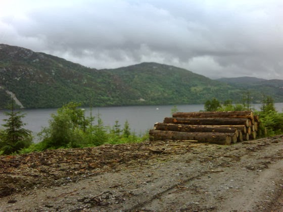
A RARE VIEW OF LOCH NESS
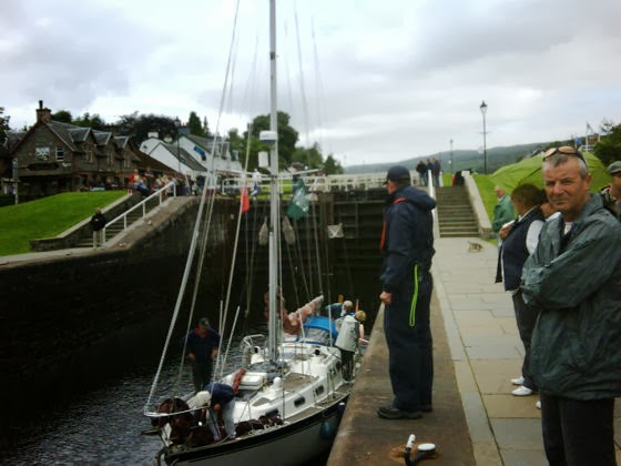
THE LOCKS AT FORT AUGUSTUS
Actually, I had already started the Great Glen Way. The official start is in front of Inverness Castle, which I had passed on my way to Rae and Dave's flat. After saying my farewells to them, I set off to complete the remaining 72 miles of the 73 mile route, which ends in Fort William. Being a Saturday, I saw many other walkers and cyclists on this popular National Trail but, because of the trees, not much of Loch Ness until I reached Drumnadrochit, where I planned to stay the night. 

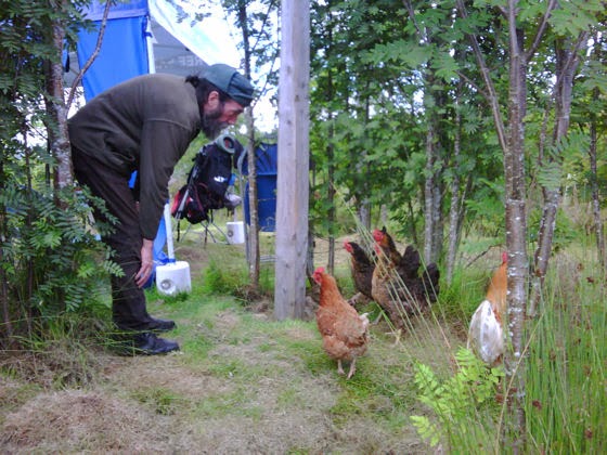
Along the way I popped into Rory's Cafe near Woodend, which was actually just a casual arrangement of tables and chairs under a gazebo in the middle of the maze of trees which is Rory's croft. He served me lemon and ginger tea while we chatted, chickens pecking at our feet. Rory shook my hand when I left. I was some way down the path before I realised I hadn't paid him, so I have donated £2 to the charities on his behalf instead. Hope that's OK, Rory. 

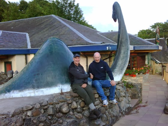
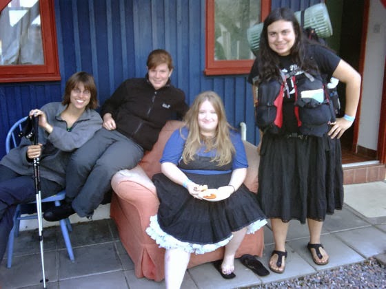
For a small place, Dromnadrochit buzzes, and the evening became quite social. I chatted to Benny and his family outside the Loch Ness Monster Visitor Centre. They were on a break from their Dumbartonshire home. Later I enjoyed the delightful company of Franca, Cristina, Anna and Zena, who were on an organised mini-bus tour of Scotland. They were staying at the Loch Ness Backpackers Hostel, but though there were no rooms spare for me, I was permitted to pitch my tent in the garden and use the facilities.

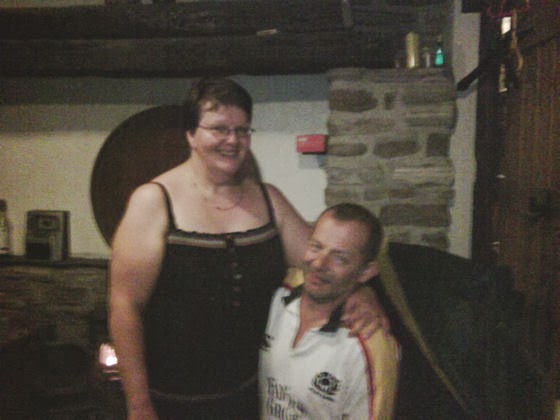
Completing various 'admin. duties' meant that I didn't leave the following day until nearly 1.00pm. The threatened rain didn't materialise, but as before there were few views of Loch Ness. Apart from a pleasant exchange of banter with two Swedes, Max and Frederick, at the half-way point, the day was uneventful. My intention had been to reach Fort Augustus, but due to my late start I stopped at Invermoriston. I was concerned about where to pitch my tent since the only bit of flat grass in the village had a 'No Camping' sign on it. An enquiry at the nearby Glenmoriston Arms Hotel revealed that nobody took any notice of this, but led to an introduction to ex-soldier Martin and his wife Frances. This wonderful couple insisted I join them for dinner at their expense and then took me to their home so that I could shower and spend a comfortable night on their sofa.

The following morning Frances cooked me breakfast before sending me on my way. The walk to Fort Augustus was more of the same, a good path but rather dull and with limited views, but the town itself was alive with activity. I enjoyed a lunch-time beer at the lock-side whilst observing the boats moving through the locks between Loch Ness and the Caledonian Canal. Indeed, the ensuing canal-side walk was a vast improvement on the earlier sections of the Great Glen Way. I moved as briskly as my feet would allow because I was determined to catch up with my schedule, and kept walking until 9.00pm to reach Clunes. The weather had deteriorated by then, so I erected my tent in the wet, but greatly appreciated the tin of beef stew Martin had given me in Invermoriston.

Friday, 24 July 2009

OSGB GRID REF. NH665433. INVERNESS

BUNKHOUSE AT BLACK ROCK - MINE FOR £14 A NIGHT
COLIN MCDONALD IN FRONT OF EVANTON'S NOVAR ARMS
ENTERING INVERNESS VIA KESSOCK BRIDGE
DAVID AND RAE MADE ME WELCOME IN THEIR HOME
I took full advantage of my sole occupancy of the bunkhouse during Thursday 23 to expedite my physical and psychological rehabilitation. Following a restful sleep, I went about getting both my grubby clothes and myself clean again. Alternating hot and cold compresses were applied to the ailing calf muscle, and I ate lots of protein to aid its repair.

The remainder of the day was spent writing my previous diary entry, and dealing with outstanding emails at a nearby internet cafe. That short walk was sufficient to convince me that the following day's scheduled 20 mile hike to Inverness was still feasible provided I took my time. The route would involve following tarmac roads and cycle paths - hard on the feet, perhaps, but less strenuous on the legs than walking on rough ground.

Evanton is a small place, so by my second evening several people recognised me, including Lee, at the Novar Arms Hotel, who had been concerned about my difficulty finding accommodation when I first arrived. I also chatted to pensioner Colin McDonald, who generously made a donation to my charities whilst explaining that he was considering participating in a sponsored abseil himself!

I left the bunkhouse at 7.30am next morning and headed initially for Dingwall, 6 miles distant. From the high-level road I could see the oil derricks in the Cromarty Firth and the A9 bridge across it. My journey then followed National Cycle Path No. 1 around the head of the Firth and all the way into Inverness. It rained most of the day, but I made only a single stop at a greasy spoon in Tore for 2 mugs of tea.

I had good reason not to arrive in Inverness late. The sister of a friend of mine, and her husband, had kindly offered to feed and accommodate me. I had not met them before, but I immediately warmed to Rae and Dave, who were great company and generous hosts. After being treated to a roast dinner and a large measure of whisky, I was ready for my third consecutive night in a comfortable bed. I slept well, satisfied that (a) I had competed what must surely be the most gruelling part of the walk, and (b) that my leg was feeling OK. Tomorrow I walk the Great Glen Way.

Wednesday, 22 July 2009

OSGB GRID REF. NH608663. EVANTON

THIS IS HOW THE CLOTHES DRYING IS DONE
ALAN AND MEL IDENTIFY THEIR CARRIAGE
GENEROUS GARY AND JACKIE AT THE BRIDGE INN
BONAR BRIDGE
A BRIDGE OVER TROUBLED WATER NEAR GARVARY
ANYONE WHO SAYS TREES HAVE EARS IS A LYRE
My howling night (see previous entry) did not apply to the weather, as by the morning of Monday 20 it was bright and clear. First job of the day was to wash some clothes in the stream nearby. That done, the inevitable presence of the midges enhanced my camp-breaking efficiency such that I was in Rogart by 11.00am.

To my delight, Rogart had a Spar store. Having survived largely on rehydrated rice and pasta for some days, my body was ravenous for protein and vegetables. I bought a basket-full of suitably satisfying sustenance and scoffed the lot at a picnic table by the Pittentrail Inn, opposite. Rain threatened as midday approached. Noting that the BlackBerry had an internet connection, I ducked inside the Inn and wrote the previous diary entry whilst waitress Beth laced me with coffee. Before leaving to continue south, I cheekily blagged some tea bags to flavour the bog-water tea I was becoming accustomed to drinking.

I had barely walked 100 yards before finding myself intrigued by a B&B called 'Sleeperzzz', just behind Rogart station, where the accommodation comprised old railway carriages. Alan and Mel, who were staying there, came over to chat. Alan had the look of a musician, and he confirmed that he was indeed an accomplished air-guitarist. Mel's role in the band was, apparently, to replace the lampshades.

Moving on, I initially climbed a steep uphill path which, according to the map, should have continued all the way across the hill. Lesson 1: Don't assume that there is a path just because the map says so. Lesson 2: If the bracken each side of a path has tufts of wool in it, don't assume the path was made by a human. What I thought would be a simple stretch turned out to be another marathon effort. I could see my aiming point in the distance, so I just kept going until I came to Dalnamain (which is a disused Shepherd's cottage) and the Strath Carnaig road. A 2-hour westerly trudge along this tarmac roadway took me to the very pleasant Loch Buidhe, where I camped for the night. I noted that only one car passed me in that time.

The morning brought with it a herd of curious cattle who I had to keep shooing away as I packed. My next stop was Bonar Bridge, which I reached half a day ahead of schedule. I popped into the Bridge Hotel, where I was entertained by Gary, Jackie and Steve for over 4 hours. The alcohol had helpfully anaesthetised my feet when I walked on late in the afternoon, heading towards Evanton across yet more hills and camping overnight behind yet another disused Shepherd's cottage called Garvary, located by a footbridge crossing the Wester Fearn Burn.

I expected the following day's trek to Evanton to be tough, and I was right. The recent rainfall meant that the rivers were in spate, so I couldn't cross where I'd expected to and had to deviate upstream (and hence uphill) to find a crossable point. I was getting used to footpaths shown on the map petering out into nothingness, and ended up hopping across pathless saturated bogland again. I gained the skill of knowing which ground would be firm from the plant-life growing upon it. I am sure that Bruce, my local Vicar, and Shirley, his predecessor, will both be delighted to know that I can now walk on 93% water.

At one point, I somehow ended up stuck in a pine forest trapped by a surging stream that seemed to flow in a complete circle around me. A fallen tree provided my escape route, but the delay cost me an hour. When I eventually reached Evanton it was 8.30pm and I had been walking for 11 hours. I was limping because of a painful right calf muscle - probably caused by the bogland clump-hopping. I decided that a rest day was due, but there was no room at the Inn! Fortunately the local 'Black Rock' campsite had a bunkhouse available for sorry cases like me and, as luck would have it, I would be the only inmate. That night I took a whisky to bed with me - for medicinal purposes only, you understand.