Sunday 30 August 2009

OSGB GRID REF. SD969179 BLACKSTONE EDGE

THE STEEP END OF PEN-Y-GHENT
MALHAM TARN
RIVER FROM NOWHERE - MALHAM COVE
BARGES ON LEEDS & LIVERPOOL CANAL AT GARGRAVE
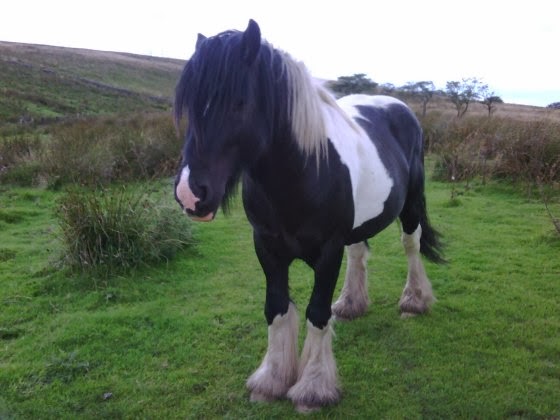
SOME SHEEP ARE UGLIER THAN OTHERS
'WUTHERING HEIGHTS' PLAQUE AT TOP WITHINS
Typical, isn't it. I climb the 3-Peaks and it rains all day. I spend a rest day indoors talking to John Manning and the weather is fine. Now, Friday 28, I'm continuing my walk and it's raining again! At least visibility is good enough to actually see the summit of Pen-y-ghent this time as I pass it on my way south.

Other than stopping to chat to a few people as we pass, the walk is quite ordinary until I reach Malham Tarn Nature Reserve with its beautiful vistas comprising a wonderful interplay of water, limestone crags and trees. Exposed limestone features strongly in the landscape here, and as I continue south I pass though the rocky Ing Scar valley and walk across a natural limestone pavement until I reach the dramatic sheer walls of Malham Cove where, like magic, the river flows out from under the base of the cliff.

I'd expected to pick up some food for the evening in Malham village but had dawdled so much that it was just after 5.00pm when I arrived and only the pub was open, and they didn't serve meals until 6.00pm. They did have a sandwich and a pasty available at the bar, though, so after washing these down with a Strongbow cider, I continued my trudge south. I found an ideal wild-camping spot in an animal-free field just as the light was beginning to fade, and erected my tent quickly in the rain.

My camping spot was just a mile north of Gargave, so in the morning I strolled down to pick up some supplies in the local Co-op and have breakfast in the Dalesman Cafe, where several folk gave me money for the charities. These shops would be the last I would see during the day. As I passed through Thornton-in-Craven, Lothersdale and Ickornshaw, the initially promising weather deteriorated into rain again. It was a shame because in dry, clear conditions these rolling hills with potentially good views would have provided a much more pleasant walk.

Crossing boggy and exposed Ickornshaw Moor in heavy rain was, quite frankly, miserable. I was glad to get across it and down to the safety of Ponden Reservoir. The light was disappearing fast by then and the ground around the Reservoir sloped steeply, but after stepping over a fence into the grounds of the local Boat Club I found a level plot suitable for the tent. I'm sure they wouldn't have minded had they known. The rain beat down heavily on the fly-sheet as I took off all my wet gear before getting my head down.

The morning of Sunday 30 August was another soggy one and the prospect of better weather seemed unlikely. After warming myself up with a cup of hot coffee, I put all my wet gear back on whilst flicking off, from the inside of the tent, all the slugs I could see crawling up the transparent inner sheet. One slug had slithered its way right up to the apex. I find it remarkable that a slug should go to all this effort when there is no food to be had at the top. Perhaps, like us, they sometimes feel compelled do things 'because it's there'.

The walk south took me into heather covered moorland again, but not with the same cold and sinister feel as Ickornshaw Moor. I am in 'Bronte country', and arrive shortly at the ruin of Top Withins, said to have been the inspiration for Emily Bronte's 'Wuthering Heights'. Further on I came to the three Walshaw Dean reservoirs and turned south at the middle one, temporarily leaving the Pennine Way. My reason for this is that I need to resupply with food for the next couple of nights using the ample facilities at Hebden Bridge, which the Pennine Way skirts around. My detour took me across Walshaw and Lancashire Moor, and past Hardcastle Crags.

Hebden Bridge is an old Mill Town, once prosperous because of the cloth trade. With its railway, canal, tall chimneys and terraced houses, it still has the appearance of a town created in the Industrial Revolution, which I rather liked.

Having completed my shopping and consumed a tasty take-away of Haddock and Chips, I continued on, rejoining the Pennine Way a mile south of the town. However, the weather started to deteriorate badly again. I could barely see the monument atop Stoodley Pike, and walking alone on the raised bank alongside the Warland, Light Hazzles and Blackstone Edge Reservoirs was spooky because all I could see was the cold black water which eerily seemed to beckon me to “come in, come in” !!!!!

At last I reached the A58 which cuts straight through the moors. It was 7.30pm by then and I decided that, with darkness approaching, to continue my walk over the exposed moorlands in thick fog and driving rain would be both dangerous and foolish. I therefore climbed over the fence of the North West Water compound opposite the White Horse pub and encamped there. As I lay in my tent, I had to admit to myself that the consistently poor weather was beginning to depress me. What I desperately needed was some more sunshine in my life.

Thursday 27 August 2009

OSGB GRID REF. SD812721. HORTON IN RIBBLESDALE (STILL)

THE REMARKABLE WESTBY FAMILY
THE PEN-Y-GHENT CAFE
RIBBLEHEAD VIADUCT
SHELTER ON SUMMIT OF INGLEBOROUGH
TRIG POINT ON PEN-Y-GHENT
JOHN MANNING CHECKS MY KIT
Having completed my report for Tuesday 25 August, who should I meet in the late afternoon but the same family from Kent that I tagged along with on my departure from Bellingham the previous week. I am pleased to see them again and get to know their names this time. I think it truly remarkable that Mum and Dad, Heather and Andrew Westby, have three teenage children, David, Sarah and Timothy, who are equally enthusiastic about taking on the onerous challenge of walking the Pennine Way, which includes camping overnight. I later enjoyed sharing supper with them at the Crown Hotel. When we said our goodbyes I was sad that I would not be meeting them again since they would be continuing along the Pennine path while I stayed to climb the Yorkshire Three Peaks.

Just as a reminder for those following this diary, the Three Peaks Challenge involves summitting three local mountains, Pen-y-ghent, Ingleborough and Whernside, totally on foot and all within a 12 hour period. They are separate mountains, so it is necessary to descend each before climbing the next. They can be done in any order and by any route, but the total distance involved generally ranges from 23-26 miles.

The Challenge starts and finishes at the Pen-y-ghent Cafe in Horton, so I rose early on the Wednesday morning, picked up the packed lunch Cynthia had left out for me and posted a note through the Cafe door registering that I had started at 7.38am. The weather was appallingly wet and I wished to avoid bogs as far as possible, so I chose to walk directly to Ribblehead Viaduct by road and start climbing Whernside, the most distant from Horton, first.

The wind-blown rain stung my face and soon penetrated my waterproofs, so I had to keep moving in order to keep warm. I was soon in dense cloud - so dense in fact that I walked straight past the trig. point on Whernside's summit without even seeing it.

Next, I dropped down to the valley and then started ascending Ingleborough, a steeper climb than Whernside but along a well-maintained path with steps that take you right up to the mountain's flat top. The descent back to Horton was long and slow, and the path quite slippery with mud in places. I made a silly route-finding mistake in the poor visibility which cost me 20 minutes, but had now cracked the greater part of the Challenge.

Although Pen-y-ghent is the most well-known of the three mountains, it is actually the most diminutive. Since it is also the nearest to Horton, I expected to dispatch it quickly. And so I did, although my hope that the weather would improve by the time I got to it was not realise. Pen-y-ghent translates to 'Hill of the Winds' and it certainly lived up to its name. The rain had been relentless, so by the time I returned to the Pen-y-ghent Cafe at 4.32pm I was wet through. I had completed the Challenge in a respectable 8 hours and 54 minutes, well below the 12 hour maximum. There was no hanging around to savour my success, though. I was getting cold now I'd stopped moving, so it was back to Broad Croft House to enjoy a hot shower.

You may well ask, what was the point of me undertaking the Challenge on a day when conditions were so utterly miserable and there were no views to be enjoyed? Well, other that avoiding any slippage of my schedule, friend Kay, who has been working so hard to publicise my venture, recently suggested in an article that I could be described as 'interesting, but crackers'. I will leave people to make their own minds up about the former, but I think I might have to concur with her on the latter.

It occurred to me later that I hadn't even thought about my shin-splint injury for a couple of days, so I think we can pronounce that one 'sorted'. I'd better send a thank you text to Reiki therapist Annabel in Bellingham.

Thursday 27 was another rest day, except that Rob had arranged for me to be interviewed by John Manning, a former Deputy Editor of walker's magazine TGO (which stands for 'The Great Outdoors') who now writes articles freelance. John was very easy to talk to and we spent more than 4 hours discussing my trek before he decided that he had sufficient material. It would clearly benefit us both if his efforts were rewarded by a published article.

Afterwards, I walked to the Crown for supper. During the evening I discovered that the couple sitting opposite, Margaret and Ray, lived in Fareham, just a few miles from my home. Moreover, they happen to be good friends of my neighbours. Small world, ain't in?

Anyway, following Wednesday's drenching, Cynthia has dried all my kit, thereby removing the only excuse I could think of for not continuing my walk tomorrow. It looks like my pleasant stay in Horton is coming to an end.

Tuesday 25 August 2009

OSGB GRID REF. SD812721. HORTON IN RIBBLESDALE

MIDDLETON-IN-TEESDALE
GOD'S BRIDGE - A NATURAL LIMESTONE BRIDGE
THE TAN HILL INN - HIGHEST IN BRITAIN
'HIGH FORCE' FOLK MUSICIANS
MY WIND-BLOWN CAMPSITE BY GREAT SHUNNER FELL
THE CROWN HOTEL
THE GOLDEN LION
ST. OSWALD'S CHURCH IN HORTON IN RIBBLESDALE WITH PEN-Y-GHENT BEHIND
Well, best laid plans, and all that. I had intended to leave Middleton-in-Teesdale by 4.00pm at the latest but I made the mistake of writing my diary in a pub. Then I got chatting to a group of ramblers; nice folk who gave me some cash for the charities. Then one of them bought me another cider. You know what it's like. By the time I left it was well past 6.00pm. I still had to transmit the diary and the pictures to webmaster Simon, and planned to do this when I had climbed out of the town, guessing that I would get a better connection higher up. By the time I had done this there was no chance whatsoever of me achieving my 8 mile target before nightfall.

I walked as fast as I could, but wasted time by making route-finding mistakes that cost me another half hour. Must have been that cider. I managed about 5 miles before the light became too poor to see adequately. Unable to find anything better, I pitched the tent by torchlight at the edge the path running around the western end of Blackton Reservoir.

Rising early next morning, I was on my way before 8.00am determined to make up for the previous day's mileage shortfall. Ahead of me were many miles of moorland peat bog to squelch through. The featureless terrain made route-finding tricky and I often had to rely on signs of disturbed grass for guidance. It occurred to me that I could easily be following someone else's mistaken route and end up walking into the same bottomless hole, to be preserved in peat forever.

After 5 hours of trudging a reward awaited me, for I had reached the Tann Hill Inn, the highest Inn in Britain. Being a Sunday it was busy, but not too busy to provide me with a terrific Sunday lunch, served in a huge Yorkshire pudding of course. Live music from a group of talented folk musicians called 'High Force' made the meal even more enjoyable, and I could easily have settled there for the afternoon, especially since the rain had set in. I sat opposite a charming couple called Quinta and Hanspeter. Quinta asked me to sign one of my 'steveslongwalk' mini-posters for her, and I obliged. I still had many more miles to cover, though, so with great discipline I donned my waterproofs and reluctantly left the Inn at 3.00pm to continue south, initially to Keld, and then to Thwaite via the North Gang Scar, enjoying the wonderfully picturesque valley views to the east.

It was a little past 6.00pm when I stopped by the Kearton Country Hotel in Thwaite to make some telephone calls (mobile communication being non-existent), have a drink and to buy some chocolate bars. With my present energy expenditure I can eat chocolate bars with complete abandon and still not gain weight. Doesn't that make all you chocoholics feel really jealous?

After consulting with a local chap, I decided to continue west out of Thwaite and climb towards cloud-covered Great Shunner Fell. The plan was to reach a plateau, part-way to the summit, where I thought I could camp. That way I could reduce the following day's distance.

The plateau was at an altitude of 597m and I reached it while the light was still good, but had to search for a plot of ground that was not boggy and had some degree of shelter from the strengthening wind. The best I could find was on the lee side of a rift in the peat. I had to hold on to the tent firmly as I assembled it otherwise it might have taken off like a kite. I pegged it down well, but it still bucked, writhed and twisted all night in response to the violent wind. However, the tent had been made to withstand such conditions, so I was not too concerned and slept reasonably well.

By morning the wind strength had reduced, easing the dismantling the tent. It was overcast, but the sun was doing its best to break through. The summit of Great Shunner Fell was visible, at 716mn just a mere 119m above me, so it didn't take me long to reach it. I then descended the long path down into Hardraw where I was astounded to meet Quinta and Hanspeter once again, sitting with another friendly couple outside the Green Dragon pub. Quinta had me sign her poster for a second time.

I needed to keep moving, though, and proceeded to Hawes where John, at the local YHA Hostel, assisted me with booking accommodation in Horton in Ribblesdale, my final destination for the day. This would be the 600 mile, or half-way point of my walk, where I had scheduled some rest time for myself. I had to get there first, of course, which involved a 13 mile route-march, during which I paid little attention to anything other than the growing ominous presence of Pen-y-ghent and the stony path of the final couple of miles which made my feet very grateful to have arrived.

I spent the evening at the Crown Hotel, enjoying their steak and mushroom pie with lots of vegetables, and chatting to fellow Pennine walker Keith.

The Crown could only accommodate me for that one night, so next morning, Tuesday 25, I moved all my stuff to Broad Croft House at the other end of Horton in Ribblesdale, where I would stay with hosts Cynthia and Rob for the remaining 3 nights.

Tuesday was spent exploring the village, and visiting it's establishments. I chatted to a couple from Oxford in the Golden Lion pub who very kindly bought me lunch and a beer. This would certainly help to build my strength up, since I intended to undertake the Yorkshire 3-peaks Challenge the following day and the weather forecast was not looking particularly good.

Saturday 22 August 2009

OSGB GRID REF. NY947254. MIDDLETON-IN-TEESIDE

GREG'S HUT BOTHY
SHELTER AND TRIG POINT ON CROSS FELL
RADAR STATION ON GREAT DUN FELL
VIEW FROM HIGH CUP NICK
I WOZ 'ERE - CAULDRON SNOUT
CAULDRON SNOUT
KAYAKERS ON THE TEES
I made an early start from Alston as I was expecting it to take a good 10 hours to reach Dufton. I initially walked alongside the River South Tyne for several miles until I reached Garrigill. This was where I noticed that my watch had fallen from my wrist somewhere along the way. I was not too concerned. Knowing the precise time had not been very important to me over the past month as my daily routines were influenced more by the light, the weather conditions and my own physical and psychological condition. Nevertheless, the watch still had its uses so I will buy another cheap waterproof one when I get the chance. 

From Garrigill the steady climb into the north Pennine mountains begins. It's raining again! I'm becoming convinced that there is a rain cloud with my name on it following me around. As my altitude increased, the strengthening headwind blew the rain horizontally into my face, stinging me around my eyes and cheeks. 

I battled on upwards for several hours until I arrived at Greg's Hut, a mountain bothy just north of Cross Fell, where I ate lunch. Several other walkers travelling in the opposite direction stopped by, advising me that the winds were dire, visibility was almost zero and the path so indistinct that I would need to use my GPS to navigate on the Fell itself (compasses being inaccurate because the hills apparently have a high iron content). It just shows how quickly conditions can change on the hills because the rain had stopped and visibility had cleared by the time I got there, although the winds were still powerful enough to make standing upright a real effort. For me, the linear walk over Cross Fell (893m) followed by Little Dun Fell (842m) and Great Dun Fell (848m) was the highlight of the day. The latter is clearly identified by the 'golf ball' dome of a radar station on the summit, for tracking aviation I am told. 

The walk from Alston to Dufton was about 20 miles in total, which is a lot to do over such mountainous territory in poor weather. I headed straight for the Youth Hostel in Dufton. It was quite full, but Annette, the Warden, not only had a bed available but even rustled up a meal for me, even though I had not pre-ordered it. 

I had decided upon the Hostel rather than camping because I needed a reliable phone connection for the following morning, Friday 21, which also happened to be my birthday. Mobile phone communication can be intermittent in the area, but Annette let me use the Hostel's land-line for my 6.45am live interview on Julian Clegg's BBC Radio Solent Breakfast Show (see my entry for 12 July '09 by clicking the 'Before the walk' tab). 

I didn't leave the Youth Hostel until late morning. Annette, bless her, let me use the Hostel's computer to send some photographs and was so very tolerant of my general tardiness when everyone else had gone. 

The climb east out of Dufton took me to High Cup Gill Head by early afternoon, the observation point for one of the most impressive views on the Pennine Way - a beautiful valley with cliffs each side and High Cup Gill meandering through the middle of the basin. 

From High Cup the slope was mainly downhill until I came to the impressive Cauldron Snout waterfall. A bit of rock scrambling was required after this until, eventually, I came upon the equally impressive High Force waterfall on the River Tees. By then it was nearly 8.00pm and it was starting to rain for the first time that day, so I found a flat piece of grass and quickly erected the tent. As I prepared my supper I reflected on what a great birthday outing I'd had. As the light faded, I celebrated with a tot a whisky before drifting off to sleep. The loud crashing of the waterfall nearby might have been intrusive to some, but to me it was just country music. 

In the morning I continued my walk along the south bank of the River Tees, passing Low Force waterfall and watching white-water kayakers enjoying themselves on some of the more minor steps. The weather was warm and dry, and the large numbers of other walkers I met reminded me that it was a Saturday. I reached Middleton-in-Teeside in the early afternoon and took the opportunity to purchase vital food and cooking gas. 

The walk from Dufton to Middleton-in-Teesdale had taken me in an easterly direction, so my direct-line distance to Land's End had actually increased. It was now time to head south into remote countryside once more. I am sending this report now as communications may be unreliable for a few days, but I hope to be at least 8 miles south of here by nightfall.

Wednesday 19 August 2009

OSGB GRID REF. NY716461. ALSTON

ANNABEL GIVES THE LEG A HELPING HAND
WATERFALL
CUDDY'S CRAGS ON HADRIAN'S WALL
BROOMLEA LOUGH FROM RAPISHAW GAP
CRAG LOUGH ON HADRIAN'S WALL
SYCAMORE GAP NEAR STEEL RIGG
INQUISITIVE LOCAL
My rest day on Monday 17 August turned out to be a very full one indeed. Guest House owner Ken informed me that he and Joy had an arrangement with the nearby Riverdale Hall Hotel to use their swimming pool and sauna. The Hotel also had an internet-connected computer for the use of guests so, after breakfast, I made my way there. Having sorted out all my IT needs, I headed for the pool, pleased that I had packed my swimming trunks in my rucksack. Next, it was into the sauna where I met Annabel, who just happened to practise Reiki Therapy at the Hotel. My shin-splint injury had still not gone away completely, and the rest of my body felt like it had been walking with a heavy rucksack for a month, so I booked myself in for a session later that day. 

I have an open mind about the benefits of such alternative therapies, but was determined to use any feasible method to get myself fit enough to tackle the Yorkshire Three Peaks Challenge in 9 days time. Annabel was aware of my ambition when she set to work on me, and I felt quite positive after the hour-long session. Moreover, she donated half her fee to my charities. 

Afterwards, I was invited to eat supper with her and John Cocker, the Hotel owner. A gathering of folk musicians calling themselves 'Cross the Wannies' were performing that night so, following an excellent meal, we were treated to their singing and playing. They also made a substantial contribution to my charities after John brought my walk to their attention. 

I returned to the Guest House to find Ken and Joy entertaining four German guests who were on the final days of a break that involved driving two Minis to an International Mini Meeting in Birmingham, and back. I didn't know that the Mini had such international appeal. It was midnight before we all retired to bed. 

Next morning's weather gave ambiguous signals, but soon decided that it was going to rain. Shortly after leaving Bellingham I found myself tagging along with a family from Kent on a walking holiday. I welcomed the company as the countryside we were passing through was relatively dull. 

I later marched on ahead and had my lunch at the northern end of Wark Forrest. It was when I had passed through the forest that the vistas really opened up with the line of Hadrian's Wall clearly visible ahead atop the crags. 

Having walked the length of Hadrian's Wall on a previous occasion, I was excited to see it again from a new angle. The Pennine Way joins the Hadrian's Wall path at Rapishaw Gap and the two routes coincide for 8 miles. This is the very best part of the Wall and I enjoyed every moment as I walked along it, especially as the weather had cleared. The views over the crags are spectacular, particularly from Steel Rigg, and there is the added interest of the Roman Milecastles and Turrets. You will note that most of the accompanying pictures are of, or from, the Wall. 

I eventually came to Walltown Quarry, which offered a perfect camp site. I ignored the 'No Camping' signs and nobody bothered me. 

In the morning I needed provisions so I walked down to Greenhead. The Youth Hostel was unoccupied and the Cafe closed, so I pushed open the door of the Greenhead Hotel to find the staff eating their breakfasts. They were happy to cook some for me too. Suitably refuelled, and with a couple or Mars bars, a packet of crisps and a packet of peanuts to last me the day, I felt ready to make Alston, 16 miles to the south. 

I was sad to be exchanging the wonderful views from the Wall for much less spectacular and rather repetitive scenery. I progressed quite quickly to begin with, but I gradually slowed as boredom set in. By the time I got to Slaggyford I was just about ready to pack it in for the day. However, I couldn't possibly stay at a place with such an awful sounding name. Alston was still 5 miles away and I was beginning to lose the will to live. I was saved by the realisation that the South Tyne Trail also connects Slaggyford to Alston by a much quicker route which is almost level and almost direct, since it follows the route of an old railway line. Note that I don't use the word 'disused', because I shortly found myself walking alongside the rails of narrow-gauge railway which was clearly in use, presumably for leisure purposes. My walk led me right into picturesque Alston Station. The boredom had left me by then. 

Alston had all the facilities I required to enjoy a beer and a meal, and replenish my food stocks for the following day. On the advice of the publican at The Turk's Head, who gave me a Highland Malt Whisky nightcap on the house, I pitched my tent down by the River South Tyne. It wasn't raining for a change.